Saturday, September 30, 2006

El Malpais mi amigo

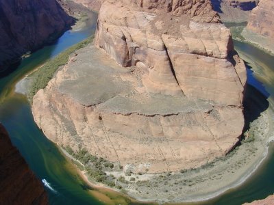
I had never heard of it, and had no inkling it might be worth seeing, but as I saw El Malpais (Bad Lands) on the map and stopped at the visitor center I became intrigued. As I began to see black lava outcroppings in the median of I-40, my first thought was that someone had an unusual way of decorating the freeway here in NW New Mexico.

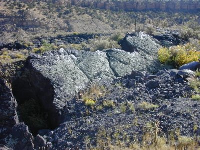
As I talked to the Ranger at the visitor center, he tried to discourage me from hiking the Zuni-Acoma trail across the lava flow. “It is just black rock piled on top of more black rock. It is unstable and sharp, hard on your boots. It all looks so much alike you can’t tell where you are, all the scenery looks the same.” he said.

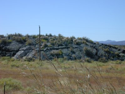
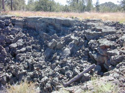
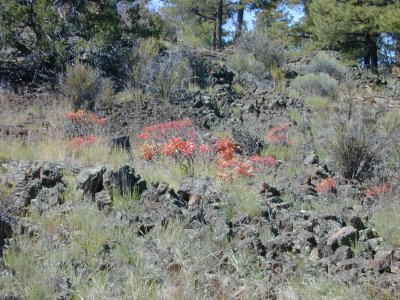
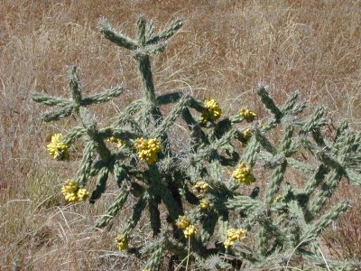
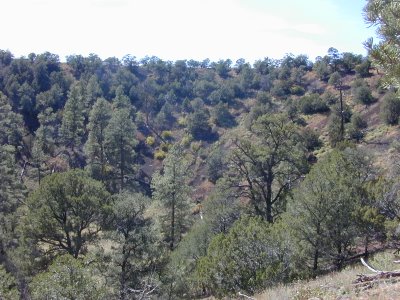
He was right, of course, and yet I’m glad I hiked at least a mile or two of this trail, which is actually a part of the Continental Divide Scenic Trail, which runs 3100 miles from Canada to Mexico along the Continental Divide. It was difficult hiking, and I was glad I had my GPS (thanks, Kevin) several times when I lost track of the trail on the endless black lava, but I had to restrain myself from leaving the trail to see what was just on the other side of each feature. You might think nothing could live in the stuff, but the cactus below was thriving. Junipers and pines grew directly out of the lava. There were wildflowers. I saw squirrels, marmots, meadowlarks, ravens, lizards as well as signs of other animals.

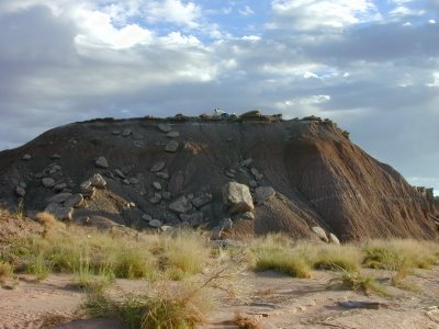
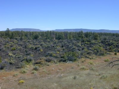
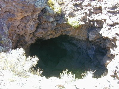
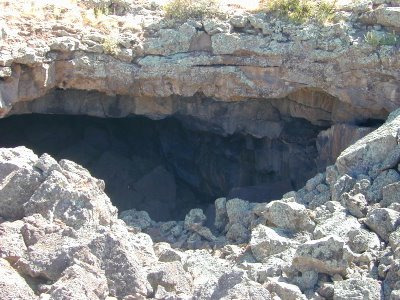
I also went on a 3.5 mile hike to volcano Calderon, where I saw lava tubes. These are large caves formed in the lava when the outer part of the lava solidifies and the inner, molten part continues to flow, creating a cave. I also saw both the cinder cone (the exterior of the volcano cone and the crater. This volcano was active about 115,000 years ago, although lava continued to flow from volcanoes in this area until about 3,000 years ago. Something about volcanoes has always fascinated me.

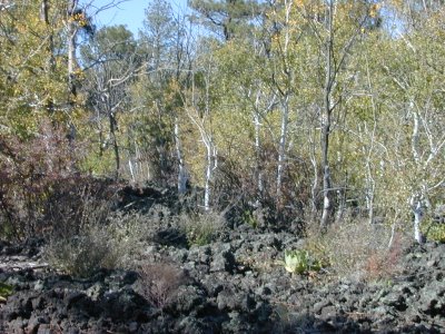
On the way down from the volcano I spotted this stand of aspins struggling to survive in the lava. I know you can’t see it, but near the left side of the picture was a red-headed woodpecker. I kept chasing him, hoping to get a better picture, but he was camera shy.

I wasn’t able to see any, but I understand that some of the lava tubes have up to 20’ of ice in them. I’m still trying to understand the thermodynamics of this. The explanations you see talk about the great insulating qualities of lava, since it is extremely porous, and about the way some are shaped just right to trap the cold air such that the temperature inside never exceeds 31 degrees. But wasn’t this molten lava? Can you really insulate yourself from hot to cold? Makes no sense to me, but I guess I’ll just mark it down as another indication that my intelligence doesn’t measure up to understanding all that I see.

Another great part of this area is the low price of accommodations. I was able to sleep in a clean comfortable room with HBO, ESPN and WI-and free breakfast for $32 per night. I saw rooms for as low as $14/night.

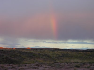
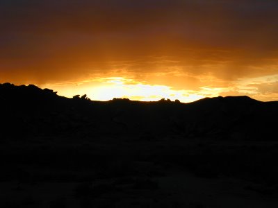
Anyway, the moral of today’s story- Keep your eyes peeled, there is no telling what new part of God’s creation you may have the opportunity to see today.

Wednesday, September 27, 2006

Lake Powell and Petrified Forest National Park

Ok, I know I said no more pictures of lakes, but Powell is the exception that proves the rule. House boats are everywhere here and you can see why, with the blue water and red hills/cliffs all around. I’ve also shown a picture of the dam which is over 700 feet high and the Colorado River downstream from the dam.


I hiked the lake rim trail as well as a trail to horseshoe bend in the Colorado river about 3 miles down from the dam.


Then, it was off to the Petrified Forest National Park in eastern Arizona. I arrived just barely in time to get a backcountry permit, which allowed me to hike into the Painted Desert. I’ve included a picture of a rainbow I saw on the hike as well as the sunset over the Painted Desert. Also, check out my campsite on a plateau alongside a dry wash and the Onyx Bridge (actually a petrified tree creating a bridge of sorts) as well as petrified wood and petroglyphs from around 11-1200AD.


Finally, a view of the Painted Desert and a Puebla, again from around 11-1200 AD.


All in all, several good days. Great scenery and great weather. Highs in the 70s and lows in the 50s. Now that is weather a Texas boy can appreciate.

Tuesday, September 26, 2006

Adios, Yellowstone. Hola, Bryce Canyon y Grand Canyon


After a couple of days exploring southern Montana while hoping for better weather in Yellowstone, I decided to try Yellowstone again. So, I drove into Yellowstone and went directly to a hike I had planned up to Specimen Ridge. This is an area where there are petrified trees, still standing where they were buried by lava. This includes walnut and redwood trees up to 8 foot diameter. These trees live only at lower elevations, confirming that this area was thrust upward. Unfortunately, about 800’ into the 1200’ climb I heard thunder, looked around and saw a thunderstorm coming in my direction. I arrived at the car just as sleet, snow and rain began pelting me. I drove for about an hour through heavy snow to where I had planned to camp. At that point, I heard on the radio that the forecast was for 12” more snow over the next couple of days, so decided to head south.


I drove south to Bryce Canyon National Park, where the weather was sunny and beautiful. I’m including a few pictures, although none of them do justice to the scenery there. And, in fact, some of the most dramatic scenery was not photographable. Southern Utah has some of the clearest air in the country, and at 9000’ elevation the night sky was amazing. It has been many years since I have seen the Milky Way so bright. And, did you know Venus casts enough light to create a noticeable shadow?

I drove into the nearest town on Sunday Morning and found three churches. One was completely vacant. No sign, no people. Both of the others were Church of Jesus Christ LDS and were large and packed. I knew that LDS was strong here, but this was unbelievable. I ended up not finding a church to attend and headed south to Grand Canyon National Park.

I visited the South Rim several years ago, so I decided to go to the North Rim. It was definitely more relaxed, but I thought not as dramatic. You can see smoke to the right side of the picture. This is an intentional burn near the South Rim village, so their view is probably not so good right now either.

Then, I found out that both the campground and lodge were all booked up and it was too late to get a backcountry permit. So, it was a late night drive on to Lake Powell, where I now am.

I'm actually downloading this from Flagstaff, Arizona and my connection is slow, so I'm going to cut this one short on pictures.

Wednesday, September 20, 2006

Grand Teton, Yellowstone, Beartooth Highway

After 2 days of hiding from the bad weather in Montpelier, Idaho, I headed to Grand Teton and Yellowstone. After attending church in Jackson, I drove straight into Grand Teton. Just a few miles into the park (Near Moose Junction as luck would have it), I saw this moose grazing in the river. This was apparently a stroke of luck, since I overheard others talking about the scarceness of moose since the fires which burned much of their habitat in accessible areas and I never saw another one after moose junction.

Maybe I’m just becoming jaded, but I didn’t see much more in Grand Teton, other that repetitive views of lakes and mountains. I am including this one additional picture of the Tetons over Jenny Lake. I spent less than half a day in Grand Teton, being so anxious to get on to Yellowstone.

My first stop was Old Faithful. It was spectacular, of course, but what really surprised me was the diversity of geysers, hot springs, fumeroles, and mud volcanoes. Everywhere I went, there were roaring steam, water and mud. Some gush continuously, pumping thousands of gallons of boiling water into various rivers. Others have gone through active stages and are just simmering now. Also amazing was the spectacular colors in some of the springs, related to the minerals in the water, although the cold weather meant that it was almost impossible to get a decent picture because of the steam. Apparently, this is an advantage of being here in the summer, when you can get clear pictures of the springs. I’ll only put 2 pictures here out of the dozens I’ve taken. This second picture is looking directly into a deep blue pool of boiling water. Grand Prismatic, which is probably the most spectacular, was completely obsured by steam.

I hiked up to Mystic falls and to an overlook 500’ up to see a view of the upper geyser basin.

I also was lucky to catch this grizzly bear near the road. I was close to the car in case he was aggressive, but he just walked right by probably a hundred people and cars, ignoring us completely.


One picture of Lake Yellowstone, with the Abasoka mountains in the background and a hot spring in the foreground.

Probably the best hike I took was along the south rim of the grand canyon of Yellowstone. I got numerous spectacular views of both the canyon and the lower and upper falls. This one is of the lower falls.


Tower Falls

I had a good hike along SheepEaters cliffs named after a tribe of indians who lived in the area and lived primarily on bighorn sheep. They were the only indian tribe that lived continuously in the Yellowstone park. They moved to the Wind River Reservation with the Shoshone when the park opened. I captured this picture of basalt columns. These are lava, which was forced up and cooled. I didn’t see the bald eagle or bighorn sheep which are supposed to be along this route, but I could imagine camping there in the evening and catching a glimpse from a cliff above the Gardiner river. By now, I was planning my escape from more rain and snow by driving up the Beartooth highway to Red Lodge, Montana and a warm hotel room. I found ice crusted on the outside of my sleeping bag this morning when I rose. I was pretty comfortable until I got out of the sleeping bag.


Last stop in Yellowstone, at least for now, was at Mammoth springs, where I photographed these limestone formations. Here the runoff is so slow the water evaporates and deposits limestone.

I drove out through the NE entrance through the BearTooth Highway, quite a spectacular route through the Gallatin, Shoshone, and Custer National Forests. The sharp peak in the center of the picture above is beartooth mountain. I got a bit concerned with the amount of snow around 11,000’, what with all the signs indicating the road could be closed without notice in case of a storm and recommending tire chains. And, of course, I was on the road because the forecast called for snow within a few hours. Ultimately, I got through well ahead of the snow, although everyone here in Red Lodge was talking about the likelihood that the Beartooth highway will close again. Apparently it was closed during the weather last week.

And, of course, buffalo. These were everywhere. They seemed to love walking down the highway. Wildlife traffic jam, as they say here. I like them better in the meadows, as per picture. Apparently there were so many they started leaving the park, presenting a problem that required them to reduce the herd. I also saw lots of elk. In fact, my campground was near a river and meadow, so I was treated to bugling each evening and into the night.

Meanwhile, I’m in hotels for the next 2-3 days. The forecast is for rain/snow through Thursday/Friday, so I’m debating my next move. I thought about Glacier, but the weather there is the same as here, except colder. Looks like lows in the teens as far as the eye can see there.

Saturday, September 16, 2006

Cold? Then how about a hotel room and football on TV?

With rain turning to snow and lows in the mid teens in Yellowstone, I decided a drive south to Montpelier, Idaho might be nice. The timing was good, as I got to watch an exciting A&M/Army game, along with several other great games.

Super 8 is turning into a second home for me, with good cable coverage and strong WiFi service, not to mention protection from some terrible weather.

I'll try again tomorrow, but beyond the next couple of days the weather forecast for the next 10 days doesn't look good. Apparently this weather is 10-20 degrees below normal, but fall is quickly approaching(It is still summer, isn't it?). I may be heading south sooner than anticipated.

I'll keep in touch.

Thursday, September 14, 2006

Flaming Gorge/Wind River

The old Cavalier seemed a bit sluggish as I pulled out of Cheyenne. I had to put my foot down to maintain 75 MPH, which is the limit here. Thirty miles later I realize why. I see a big monument(above), pull off and realize the temperature has dropped about 20 degrees. I’ve gone from about 6500’ elevation at Cheyenne to about 8500’ just east of Laramie. The monument is at the highest point of I-80 and celebrates US 30, the first Atlantic to Pacific highway, dubbed the main street of the nation. The highway was build as a private enterprise!!! Only later did it become the role of the state to build highways.

My next stop is in Flaming Gorge National Recreation Area. I hadn’t planned to stop there since I’ve visited there before. But it is at the junction of I-80 and US 191, by Rock Springs, right on the way to Yellowstone. My previous visit was because Rock Springs is where I often stayed while working SW Wyoming in the oil business. By the way, I waved and smiled at the old BP Wamsutter office as I passed!

It seems to me that the park never quite lives up to the expectations of a name like Flaming Gorge, but to be fair I visited only the northern part which is convenient to me, not the southern part which is located in Utah. I have included two pictures, both taken from my campsite. The first is of some formations located just across the Green River. The second is of three deer, which have a bit of a story… I was sitting at my campsite finishing up dinner when I hear a huge thundering noise coming from behind me. I was startled, to be honest. I thought I was about to be run over by a heard of buffalo. I look up to see these 3 deer running full speed toward the Green River and within 50 feet of me. I just managed to get my camera up before they disappeared over the bank. I think they were as startled as I was.

I know you can’t make it out, but I included a picture of wild horses(Believe me, they are in the distance in this picture of scrub brush, which is typical of this part of Wyoming). Horses were native to North America until about 10,000 years ago, when they seem to have mysteriously disappeared with several other species such as the woolly mammoth. However, they were reintroduced or reappeared in the early 1700s and were captured and utilized by the Indians. Wyoming is one of the few places where there are still wild horses roaming the plains.

From there it is off to Pinedale, the jumping off place into the Wind River mountain range. There I visit with the National Forest Service and Department of the Interior for info and maps. I camped at the Trail’s End camp ground, which is at the end of the road leading into the Wind River range and hiked about 10 miles to get a picture of myself with the Wind River Range as a background, using my Photo Leki walking stick (Thanks, Earl). In the picture you can see Suicide Lake at around 8500’ elevation toward the bottom of the picture as well as the peaks of the Wind River range at around 13,700’ from my vantage point at about 10,250’. I also captured the photos of Sweeney Lake and Miller Lake(bottom of page) on the trip. All these lakes, and there are hundreds, are natural, glacial lakes, formed by glaciers back in the last ice age. As you hike, they just seem to appear out of nowhere in the backcountry. Oops, I threw in a picture of a mule deer I saw on the hike. I didn't plan to show it, since it is so bad, but I can't figure how to delete a picture once I've downloaded it.

Oh, and don’t forget the snapshot of a couple getting around by horseback, with the mountain range in the background. That is the way to get around in the backcountry, and surprisingly to me this is very common. Most of the hiking trails are shared with people on horse back.

Wind River bills itself as “Better than Yellowstone” and I have to admit they are beautiful, helped by great weather and an awesome sense of wilderness. It has been sunny and warm, although the temperature drops into the 30s at night in the mountains. Tomorrow, Thursday, I’ll be heading to Grand Teton and Yellowstone to check out the claim. Hopefully the weather will cooperate, although I heard from some folks on the trail that a front is expected tomorrow, with forecasts of snow and lows in the 20's. Of course, they had to tell me about the time when they got 3 feet of snow on August 31st, right here in the Wind River area.

Finally, a photo of sunset over the Wind River Range.

Check you later.